3. Tourist Information : Welcome to the Avesnois;
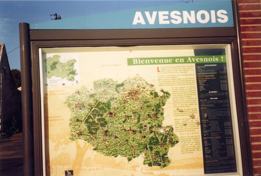
In the middle of the town of Pont-sur-Sambre stays an information sign-board about Avesnois with a map. It is in every town or village of the Parc Naturel Régional or regional nature parc.
photo : dominique/perle de rosée.
Poster on a public sign-board : office du tourisme de l'Avesnois.
Posted by perle de rosée to Pont-sur-Sambre daily photo at 2/18/2006 01:29:00 AM
Links :
The same in german. Le même en allemand. Das gleiche auf Deutsch.
The same in french. Le même article en français. Das gleiche auf Französisch.
Perle de Rosée.
Libellés : Avesnois, maps, sign-boards, welcome board


6 Comments:
Tiens? Un Daily Photo de plus? Excellente idee!!!
Envoyé par San Francisco Daily Photo à Pont-sur-Sambre daily photo le 2/19/2006 04:55:18 AM
Translation of the comment I made on the french translation...
Is it the treasure card ? And where is the treasure ?
The treasure is the green nature and all the good old architecture you can find here. And also the products of the farmers and specialities.
This land is no island although it could be the Isle of the treasury. It is in the North Country of France which is a big insdustrial country and which was called the black land in cause of its coal mines. The Avesnois is its green heart. The region of France to which the Avesnois belongs is the Nord-Pas de Calais. It is at the South East of the department Nord which is the North Department along the border of Belgium. It is also the higher part of this "Lowland". The top of it is at its South-East end point, on 270 meter high in Anor. The "chef-lieu d'arrondissement" (district capital town) is Avesnes-sur-Helpe which have less people as the biggest town of the aera, Maubeuge. In the East of the Avesnois is also Belgium, in the North of it Belgium and more in the West the Valenciennois or region of Valenciennes. In the South is the department Aisne of the region Picardie and in the West is the Cambraisis or the region of Cambrai. In the East of the Avesnois you can go very quickly to the department of the Ardennes, a department which a little ancient mountain, which is only 30 km far from the South-East corner of the Avesnois; perharps many people in the world didn't hear of all this towns, but there are towns with a big cultural life.
Posted first by Perle de Rosée to Pont-sur-Sambre Daily Photo at May 22/2006 at 02:11:24 PM. Updated to-day.
It is a good thing to make such a map. We can see where is the West and the East Avesnois and also the great forest of Mormal? But where is this land? Is it an island ?
Posted by dominique/dominika to Pont sur Sambre and Avesnois Daily Photo at May 22th 2006 01:29:22 PM
(re-edit)
This was my right comment on the blog in ENGLISH.
The comment just above is the question to the fourth comment above !
I give here also a link to San Francisco Daily Photo so that you can find him.
http://www.sanfranciscodailyphoto.com/sfdp/today/index.html
<< Home